China, Japan & Korea Maps
Antique maps of China, Japan &Korea. See China, Japan &Korea Scenes & Views for landscape prints and genre scenes.


About antique maps of China, Japan & Korea
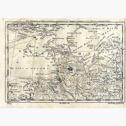
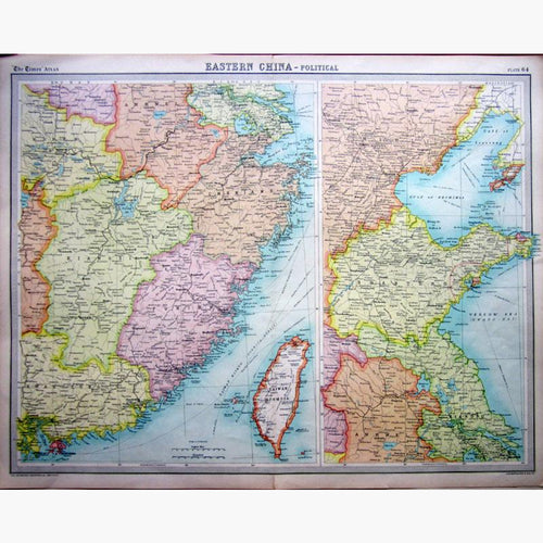
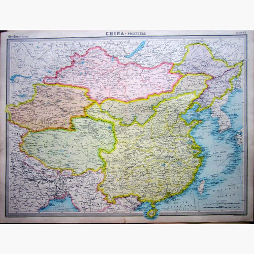
The earliest recorded map mentioned by historian Ssu Ma Chien was presented to the Prince of the State of Chin in 227 B.C. The oldest known extant Chinese maps engraved in 1137 on 2 stone tablets are preserved in Hsianfu. I have a large selection of antique maps of China. I also have engravings of China.
The first information on China was obtained by accounts of Marco Polo (1271-95). The first European map of the world circulating in China was by Matteo Ricci printed in Shao king in 1584. In the 14th century Choo Sze Pun compiled the Kwang yu too and the maps were used in 1655 by the Jesuit Father Martini for the Atlas Sinens, published by Blaeu in Amsterdam.
China is the world’s most populous country. The Chinese civilization was one of the earliest. It flourished in the fertile basin of the Yellow River and its tributary, the river Wei, in the North China Plain. China is one of the largest countries in the world. It has high table-lands, broken mountainous country, rivers breaking through stupendous ranges of mountains, and the deltas of the Yellow river, the Yang-tze-kiang, the Peiho, the Sikiang and other rivers. The Tian Shan or Celestial Mountains stretch from East to West about 1500 miles. Tian Shan, the Himalayas, Pamir and the Karakoram mountain ranges separate China from South and Central Asia. There are forest steppes and the Gobi and Taklamakan deserts in the arid north west. In the wetter South of China there are sub-tropical rainforests. The great deltaic plain in the north-eastern portion of the empire is about 700 miles long and about 500 miles in breadth.
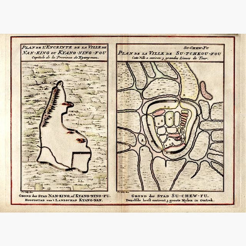
I have a plan of the town and environs of Nan King and Su Tcheou Fou, by Jakobus van der Schley, hand coloured, dated c.1747.