Ottoman Turkey & Persia Maps
Antique maps of Ottoman Turkey and Persia. See Ottoman Turkey & Persia Scenes & Views for landscape prints and genre scenes.


About antique Ottoman Turkey & Persia
maps
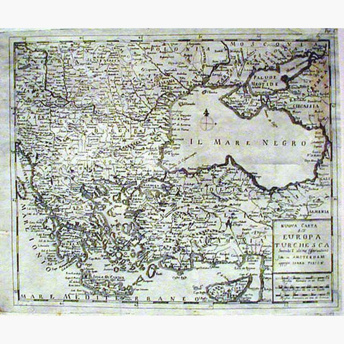
From the period of the Conquest of the Byzantine Empire in 1453 to the Treaty of Sèvres in 1920, the Ottoman Empire consisted of European and Asian Turkey.
Turkey in Europe
Turkey in Europe consisted of 195,000 square miles of territories in the northern Mediterranean and Balkans, with a population in 1820 of 8 million people.
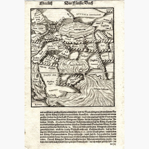
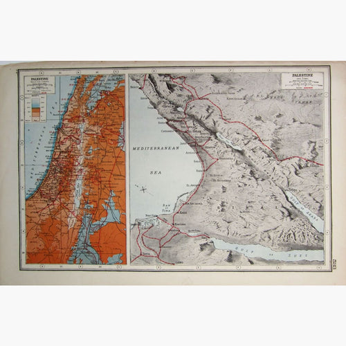
Turkey in Asia
Turkey in Asia consisted of 494,290 square miles, encompassing most of what is now called the Middle East, with a population in 1820 of 12 million people.
Turkish dominions in Africa stretched from the frontiers of Tunis, along the western shore of the Red Sea to the frontier of Abysinia, inland to Tripoli, Fezzan, Barca, and Egypt.
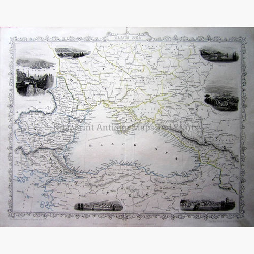
Russia gained the right to maintain a fleet in the Black Sea after two wars 1768-1792. In the 19th Century the Ottoman Empire was weakening. Russia supported the rise of Nationalism with the independence of the former Ottoman provinces of the Slav people of the Balkans. Romania, Serbia, Montenegro and Bulgaria achieved Autonomy. .
Britain, France, Austria and Russia tried to take advantage of the potential crumbling of Turkey. In 1826 Mahmud II abolished the Janissary corps, and established a modern Army. The Western powers feared that under the pretext of defending the Orthodox Christians (treaty of Kuchuk Kainarji 1774), Russia would continue to expand South.
This led eventually to the Crimean War (1853-1856) See Battles.
The Treaty of Sèvres abolished the Ottoman Empire, and obliged Turkey to renounce all rights over Arab Asia, and Africa.